3D Planning with Drones
PV planning with 360° views: drones for photovoltaic systems
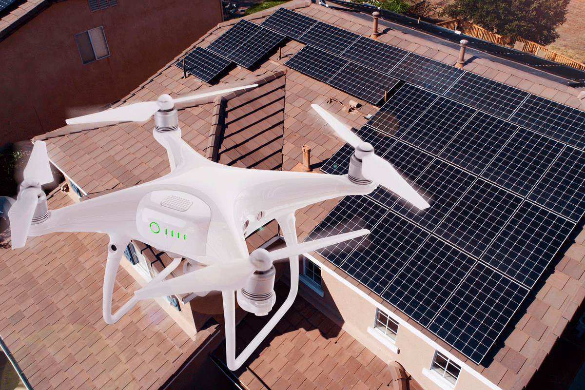
No detail escapes the drone. Drones capture a bird’s eye view of projects in precise pictures from previously unseen angles. Is your roof uneven or undulating? Do shadows from lightning protection and ventilation equipment block direct solar radiation? Photovoltaic drones find any potential weak spots. Their images form the basis for precise building and roof drawings in 3D. This allows the photovoltaic system on your company’s roof to be designed and installed to provide efficient solar power, even in challenging situations.
An alternative to a manual roof survey
Investing in solar systems pays off in many ways: they give you independence from the public power grid, produce environmentally friendly electricity and represent an investment with a short amortisation period. However, even very small roof-top objects such as extractor fans, chimneys, rooflights, lightning protection, ventilation equipment and rainwater outlets can decrease the solar yield from your PV system. If lack of building plans adds to the difficulties, SENS PV experts climb onto the roof with a ladder, sometimes even a cherry picker, and measure by hand using a measuring tape, folding rule or laser distance meter. 3D digital models created from drone images are a good alternative to this type of manual survey for planning, realising and maintaining your PV system.
Efficient and precise – drone surveys
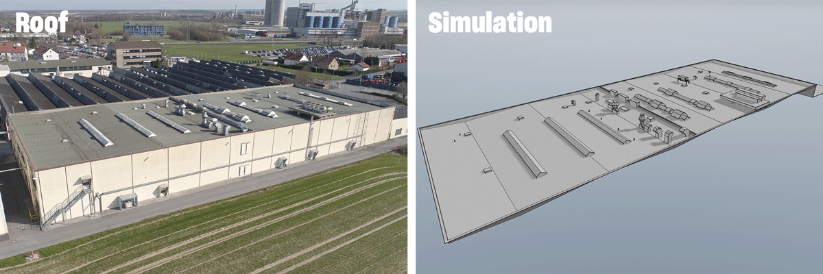
A drone survey is particularly useful for complex roofs or those on older, larger industrial or commercial buildings. The drone pilot creates high-resolution aerial photographs of your roof from a bird’s eye view. They capture all the important data: roof slopes, ridges and valleys, interfering objects such as rooflights or chimneys and their heights – quickly, precisely and safely. From the photographs, state-of-the-art software creates a 3D model of the roof as it stands – an inventory with dimensions and topography. Lengths, areas and angles can be determined to centimetre accuracy. Detailed shadow analyses and shading impact simulations can be done to avoid the adverse effect of shadows from interfering objects. Using this information, we can reliably estimate the yield from your PV system. During installation as well, SENS experts can use drones to record progress on site or, for example, to create a simulation that shows the precise course of the sun and the resulting shading – over a day or a season.

Inspecting and troubleshooting your solar system using drones
Among the range of services SENS can provide are the servicing of solar systems, solar module cleaning, perimeter fence inspections and damage repair. Defective solar cells can significantly affect the efficiency of individual modules, while the weather and UV radiation can corrode electrical components. Therefore, SENS experts check the performance of the solar modules during manufacture and after installation – to ensure the system operates perfectly.
Visual inspection of PV systems: drones with thermal imaging cameras show up weak spots
Thermal imaging cameras are a popular tool for inspecting solar cells and modules. During photovoltaic equipment inspections and maintenance using drones fitted with thermal imaging cameras, we check whether a PV system is supplying full power and look for thermal abnormalities. Anomalies that can lead to performance reductions are clearly recognisable from the thermal images using thermography.
Models in augmented and virtual reality
Digitalisation of PV planning allows SENS to offer 3D visualisation of solar system models using Kubity, a new 3D communication tool that runs on various devices and works with augmented reality hardware and virtual reality glasses. The models can be displayed on Google Earth using Google SketchUp in your browser.
Conclusion: drones for more efficiency and higher yields
“Used in addition to our site visits, drones are a good tool for accurately recording a building. Moreover, they allow us to minimise consequential costs in the case of modifications during installation,” says SENS planning engineer Sascha Link. “Particularly with complex roofs and where drawings are not available, we offer drone surveys as an additional service.”
The advantages of drones, planning software and 3D visualisation:
- Even more efficient use of surface areas: higher overall yields
- Lower ballasting: less load on the surface supporting the installation system conserves the roof’s reserve load capacity.
- Fewer attachment points by using ridge-valley connectors
Find out more about maximising long-term solar electricity yields with our professional roof and ground surveys using drone images. We take an all-round view of your photovoltaic system – for inspections, maintenance and assessments.
We’ll be happy to advise you. Contact us now!
Send us about a drone survey an e-mail to sens@iqony.energy or simply get in touch with us directly using the contact form.
Symbol Picture: Shutterstock
